Sai Kung Waters
Boat Tour of the Sai Kung Volcanic Rock Region
Ung Kong Group and Ninepin Group have no tourist facilities (such as public pier or trail) available. To prevent accidents, please observe from a boat and avoid getting ashore.
Given the considerable number of geosites and the distance between them, consider taking two separate boat tours to see all the geosites of the Ung Kong Group and Ninepin Group.
Sightseeing Route for the Ung Kong Group
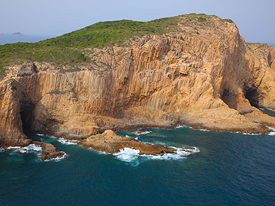
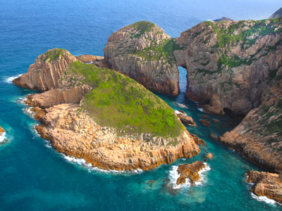
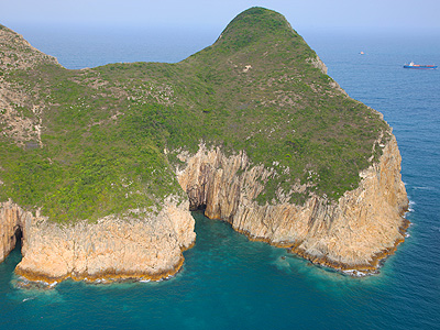
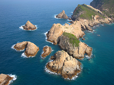
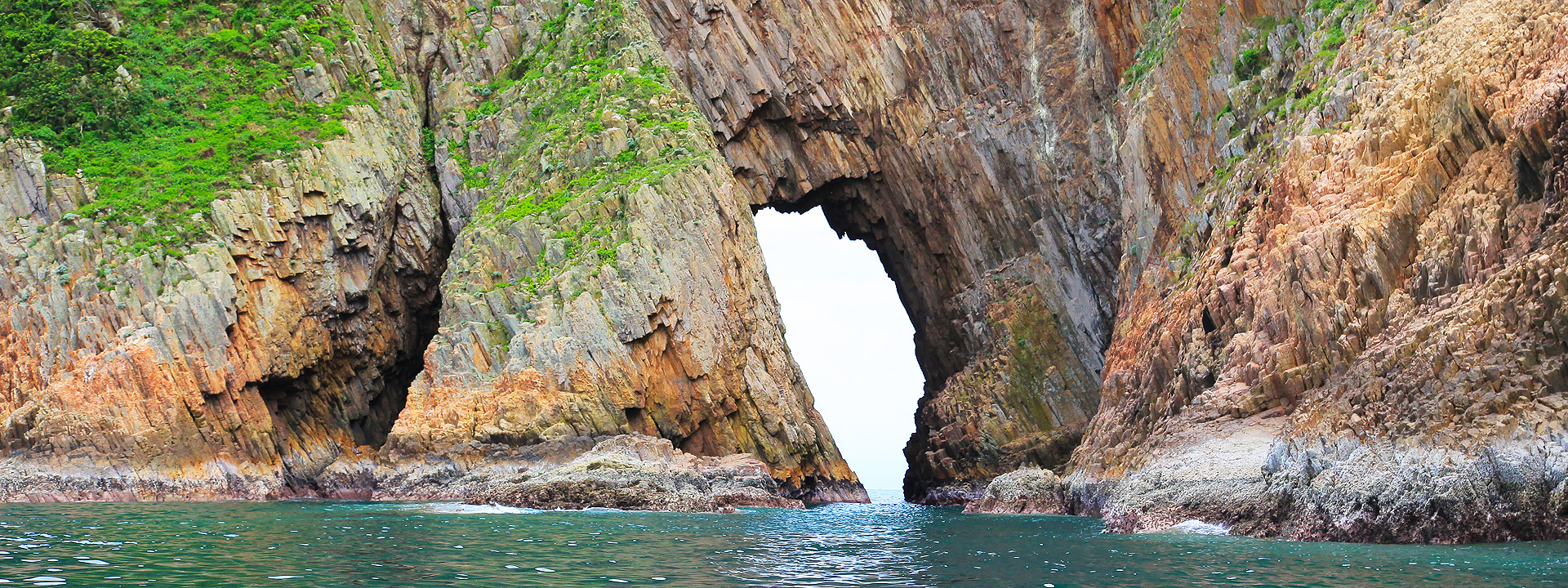
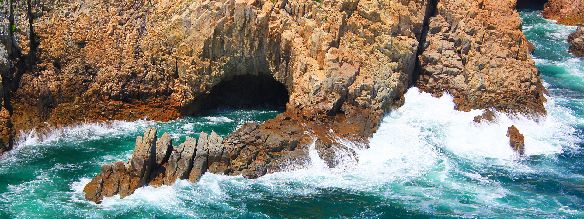
You can join a geopark guided tour or hire a sightseeing boat. From Sai Kung Pier, you will reach Jin Island in about 30 minutes. The rock there is rather fragmented, but the form of the hexagonal rock columns is clearly visible. Jin Island got its Chinese name from a bell-shaped sea arch at its south end. One of the four great caves of Sai Kung, this “cave” is geologically a sea arch. Sailing on, you will soon come to Fa Shan, of High Island, where a neat array of soaring hexagonal rock columns lines the shore. This extensive stretch of “rock column coast” is truly awe-inspiring. At the end of Fa Shan is an islet, called Po Pin Chau. Viewed from the land vantage point atop the High Island Reservoir East Dam, Po Pin Chau is a spectacular sight; viewed from the sea, it will simply take you breath away. Its towering rock columns arranged uniformly on the sea cliff make the formation look like a giant pipe organ.
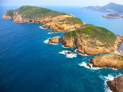
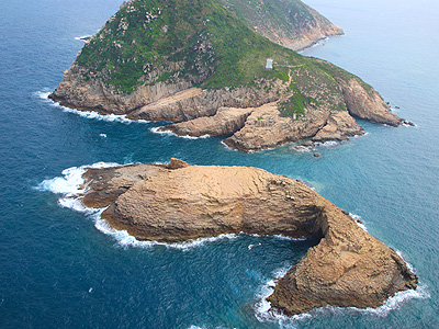
The Ung Kong Group lies south of Fa Shan. A 10-minute boat ride will take you to the famous rock column mural of Wang Chau. Not to be missed are the other three great caves of Sai Kung: Big Cave (also known as “Little Taiwan”) on Wang Chau, Guan Gong Knife Cave on Basalt Island and Candle Cave on Bluff Island.
Basalt Island, the biggest member of the Ung Kong Group, lies south of Wang Chau. The Chinese name aptly reflects a volcanic rock island, while the English name suggests an interesting misunderstanding. Since most hexagonal rock columns around the world are made of basalt, someone mistakenly assumed that the hexagonal columnar rock on the island was basalt before geological surveys were carried out. Thus, an inappropriate name was chosen for the island. The Ung Kong Group is situated in the outer marine region, where high winds and rough seas are common. Do not visit shortly before or after a typhoon or on days when easterlies persist.
Sightseeing Route for the Ninepin Group
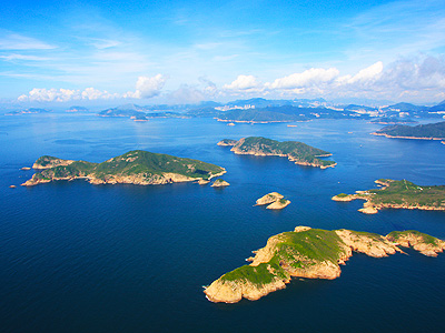
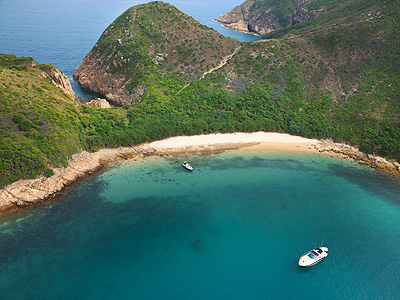
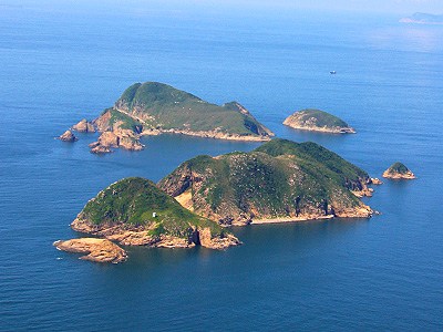
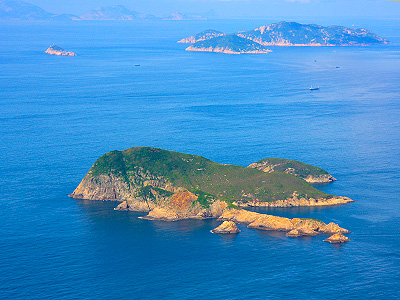
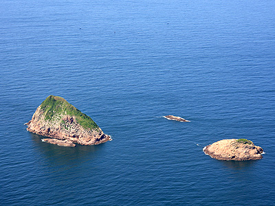
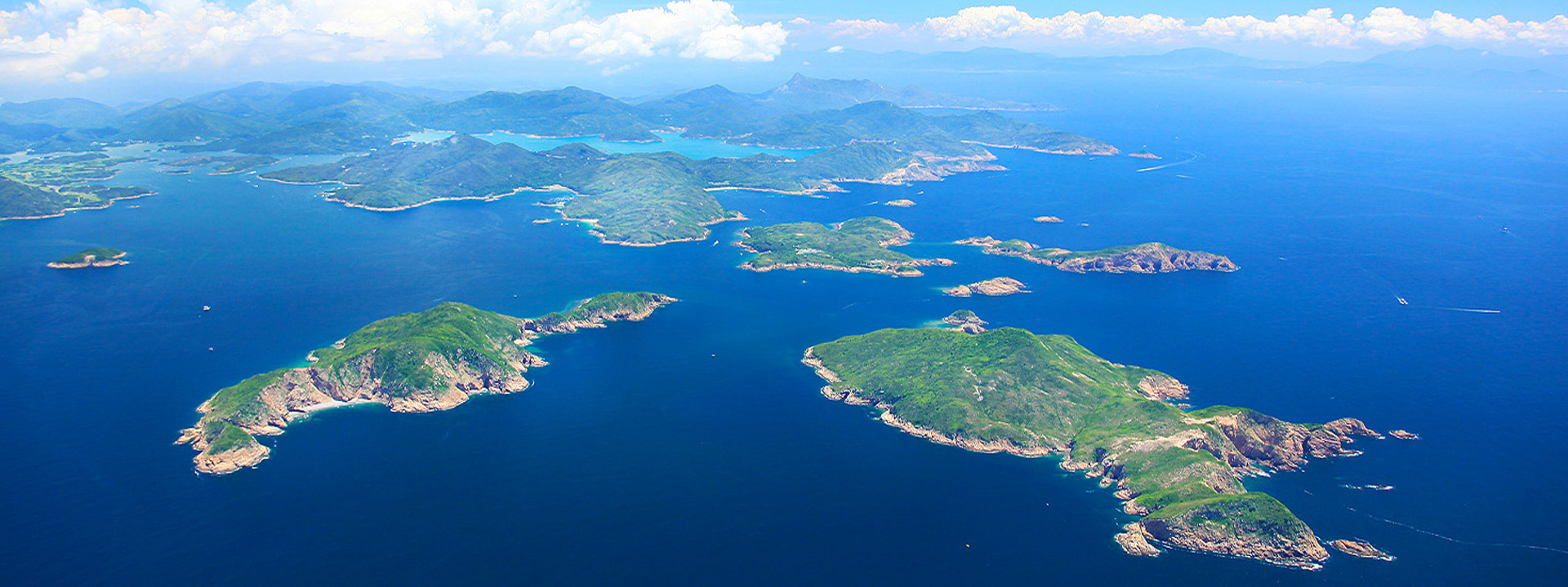
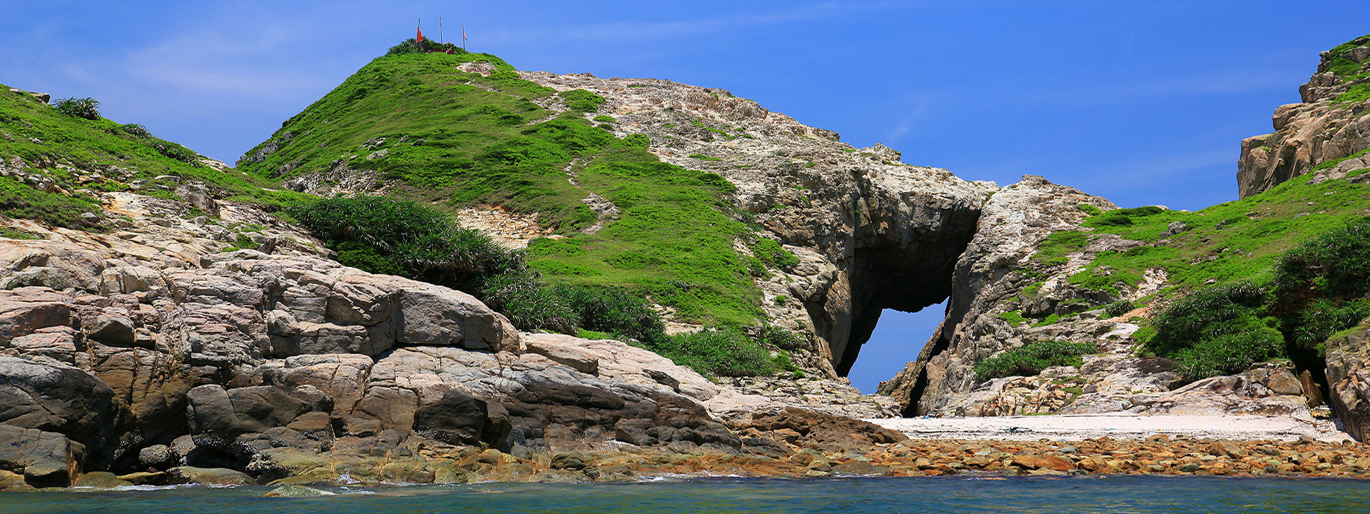
The Ninepin Group can be reached in about an hour from Sai Kung Pier, and about half an hour from the Ung Kong Group. The main islands are North Ninepin Island, South Ninepin Island and East Ninepin Island. North Ninepin Island consists of Sai Chau Mei, Hok Tsai Pai and other islets; South Ninepin Island comprises Tai Chau, Tai Chau Mei, Shan Leng Kok and other islets; and East Ninepin Island comprises Tuen Chau Chai, Shue Long Chau, Lung Shuen Pai and other islets. Ninepins is an old English game similar to modern-day bowling. In the early years of colonial Hong Kong, the formation of these islands reminded British seamen of the familiar game back home, so they came up with the name Ninepins. They were indeed creative, but not as creative as the local fishermen, who named the islands Fruit Platter. To appreciate how fitting this name is, you have to see an aerial photo of the group. Viewed from above, the rugged Ninepins are scattered in the vast blue sea, as if a fruit platter had been toppled in heaven, and the fruit landed on earth, forming a group of curious-looking islands in the sea. To the east from South Ninepin Island, the open sea extends all the way to the Philippines with no land whatsoever in between. No wonder the fishermen built a Tin Hau Temple at land’s end to pray for protection. The Ninepin Group is a barren wilderness. There is only thin coverage of grasses, shrubs and coastal plants, like Beach Naupaka and Screw Pine. Most of the areas have no vegetation at all.
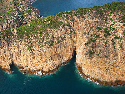
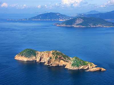
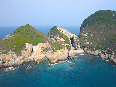
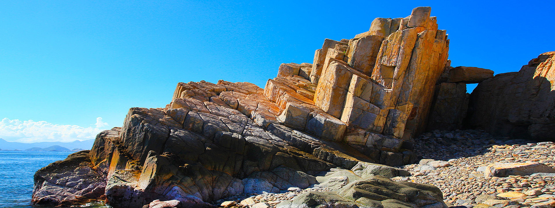
The hexagonal columnar rock formations occur mainly on North Ninepin Island. The most extraordinary specimen is found in Ngan Peng Keng, where two massive fault planes offer a full view of cross sections and profiles of the rock columns. This extraordinary sight is so other-worldly that many people call it “Moon Cliff”. On Yuen Shek Pai, south of North Ninepin Island, hexagonal rock columns encircle the centre of this islet step by step, forming a natural “spiral staircase”. Famous attractions on South Ninepin Island include Tiger Mouth Cave, Y-shaped Cave and other sea caves. The Ninepins are remote islands. High winds and rough seas are common on days when easterlies persist, so visits are not advised.
In Hong Kong, southwesterly winds are common from summer to early autumn. The sea is relatively calm during this period, making it the best time for boat tours. There are no countryside facilities on Jin Island, Fa Shan of High Island, the Ung Kong Group or the Ninepin Group. To ensure safety, do not go ashore or climb on the rock.
*Suggested sightseeing time: 4-5 hours
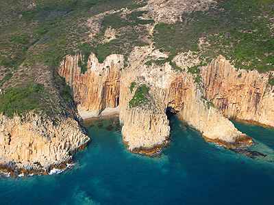
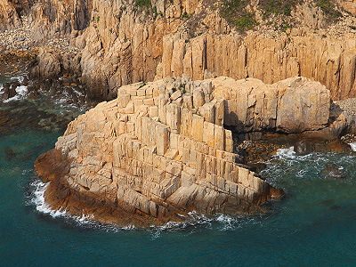
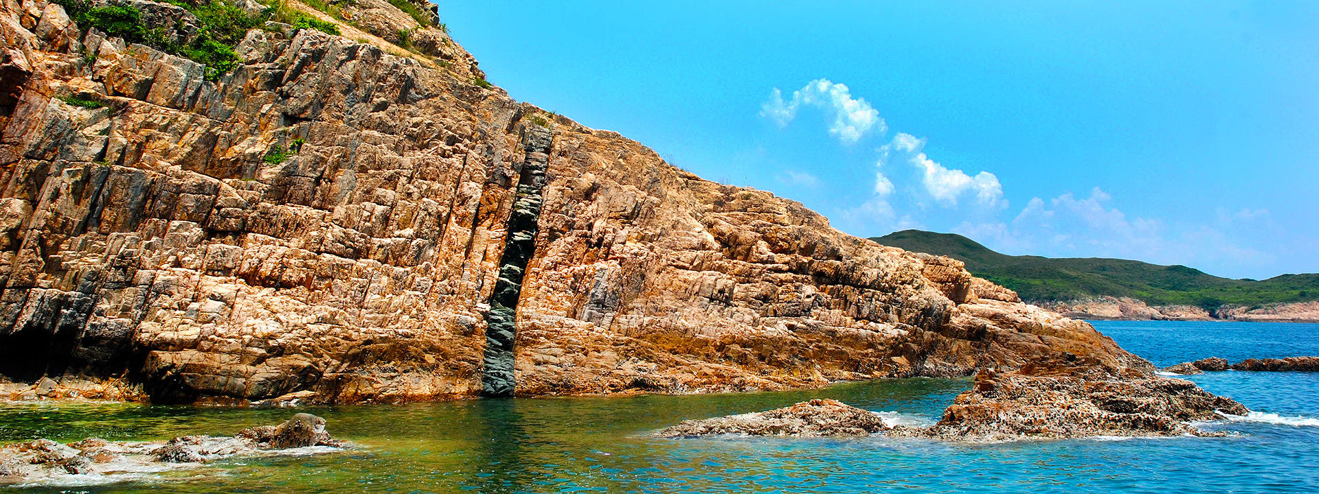
About 140 million years ago, an active supervolcano, which spanned the whole Sai Kung region, erupted and collapsed. A huge 18-km-long oval basin emerged, called a caldera. Volcanic activity produced a large amount of molten state volcanic material, which was deposited inside the caldera. Under stable environmental conditions in the semi-enclosed caldera, these substances cooled down, congealed and contracted in a regular pattern. During the cooling process, hexagonal network fractures appeared and extended downwards vertically. Eventually, the volcanic materials were sculpted into millions of hexagonal rock columns. Today, hexagonal columnar rock is widely distributed across the site of the ancient caldera, covering the Ninepins, the Ung Kong Group, Tai Long Wan, High Island (including High Island Reservoir and Fa Shan) and Kau Sai Chau.
The hexagonal rock columns in Hong Kong are very different from similar rock formations in other parts of the world in both texture and chemical composition. While hexagonal rock columns are found in many regions around the world, most are composed of high-temperature, highly mobile and low-silica basalt. By contrast, hexagonal rock columns in Hong Kong are low-temperature, less mobile and silica-rich rhyolitic volcanic rock. In theory, this volcanic material very seldom develops into hexagonal columnar rock. The rock also has a complex texture, which displays features of lava and tuff. It is truly a globally rare of Hong Kong’s geoheritage.
Hong Kong’s hexagonal columnar rock formations have undergone weathering for more than 100 million years, but columns up to 400 metres thick are preserved to this day. Land and sea distribution is over 100 km2 (including marine regions), and the average column diameter is 1.2m, with the largest specimens measuring 3m. Some islands and sea cliffs have columns up to 100m high. These formations are integrated with other coastal erosion landforms, such as sea caves, sea cliffs and sea arches. Together, they make up globally rare geomorphological landscapes and world-class geo-wonders.
Join a boat tour:
http://www.hkr2g.net/en_geotours.htm