
NENT Waters
Boat Tour of the Northeast New Territories Sedimentary Rock Region
Bluff Head has no tourist facilities (such as public pier or trail) available. To prevent accidents, please observe from a boat and avoid getting ashore.
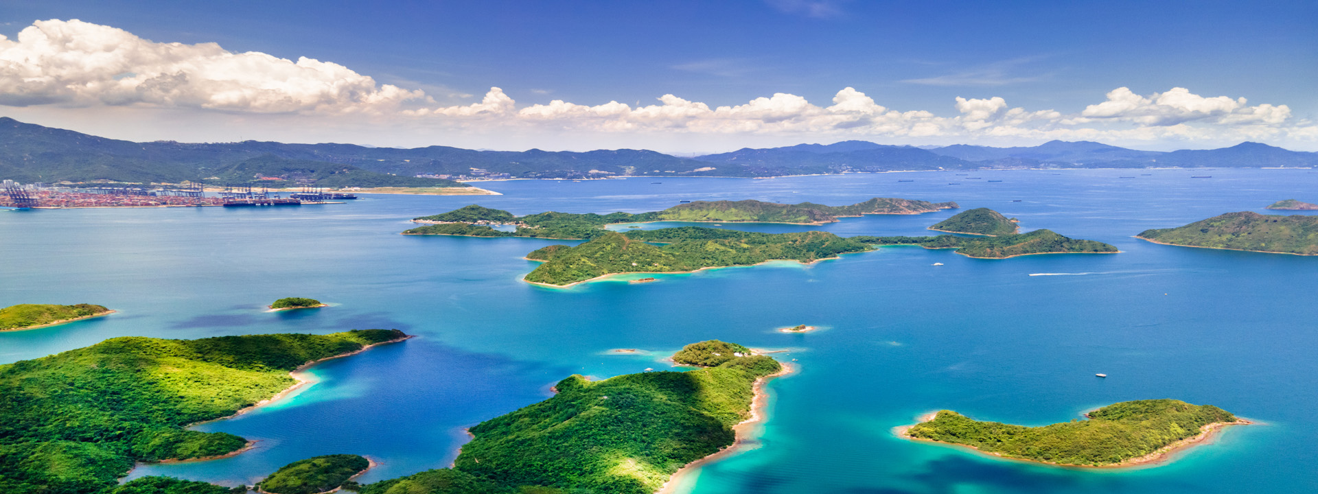
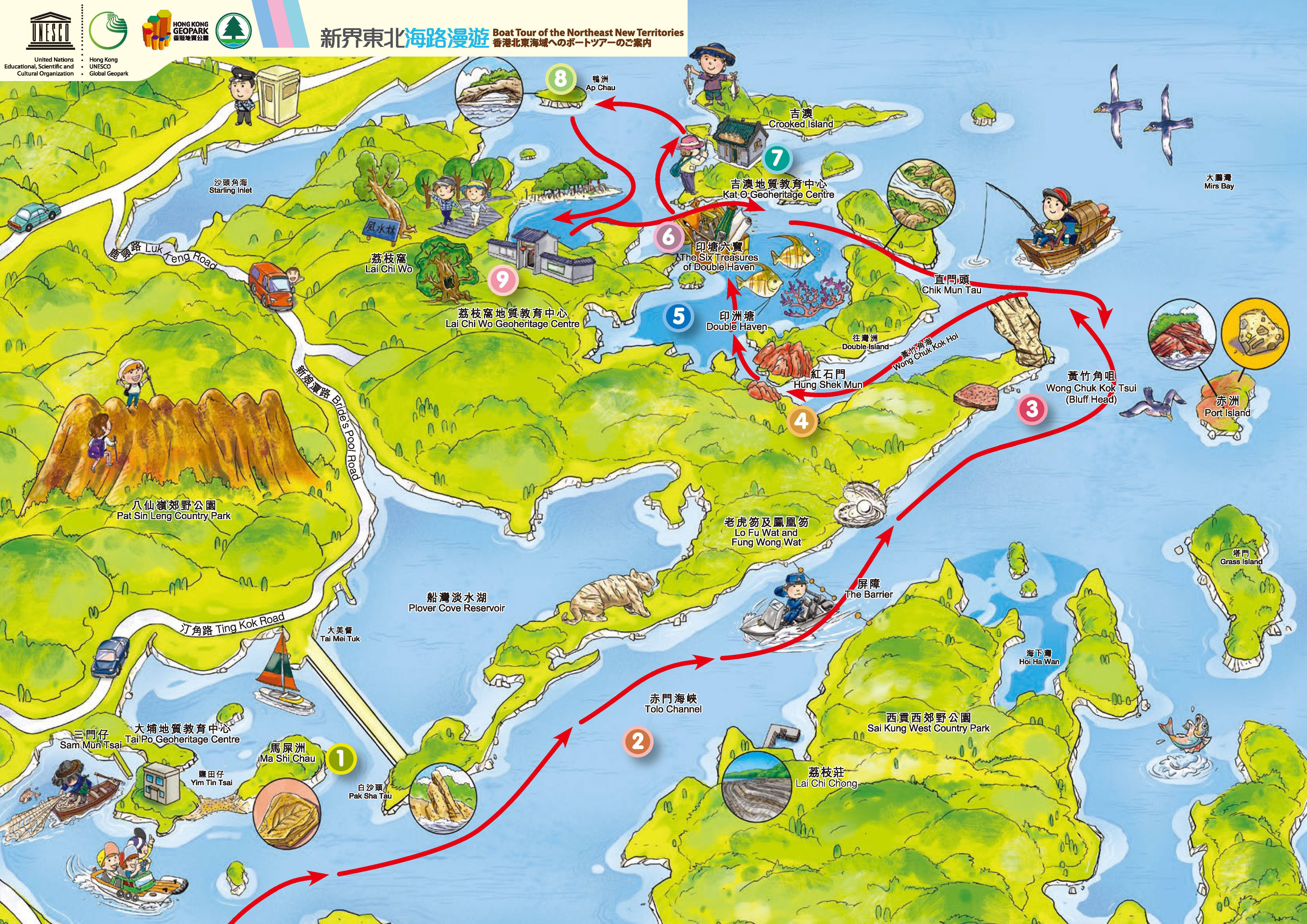
Start your journey at Ma Liu Shui Pier. As you sail through Tolo Channel, the first geosite that comes into view is the oldest stratigraphic section in Hong Kong ― Bluff Head. As you continue to the southeast, the striking red Port Island comes on stage. Past Hung Shek Mun, the boat enters Double Haven, an idyllic part of Hong Kong, known as Little Guilin. Feast your eyes on the picturesque scenery and the famous Six Treasures of Double Haven. If time allows, stop at Lai Chi Wo, Kat O and Ap Chau for land excursions.
*Suggested sightseeing time: 4-5 hours
The rock on the banks of the channel is set on two sides of the fault. Violent geological activity lifted the horizontal stratum to a nearly vertical position. The north coast of Tolo Channel is composed mainly of sedimentary rock, including white quartz conglomerate, pastel and red sandstone, and reddish-purple siltstone. Geological surveys have found fossils of four prehistoric fish, as well as many bivalves and brachiopods. Fossils of prehistoric plants were also discovered in Ma On Shan on the south coast. Analytical research reveals that these animal fossils lived in the distant Devonian Period, about 420 to 360 million years ago, confirming that these strata were formed in the Devonian. This is the oldest rock in Hong Kong. A combined analysis of sedimentation conditions and life assemblages in the Devonian shows that the north coast of Tolo Channel near today’s Plover Cove was essentially a littoral, estuarine delta or paralic-neritic sea sedimentary environment some 400 to 300 million years ago. Therefore, fossils of estuarine delta fish, marine fish and other marine species have been found. Subsequently, sea level fall or land uplift transformed it into a terrestrial environment, in which primitive ferns took root.
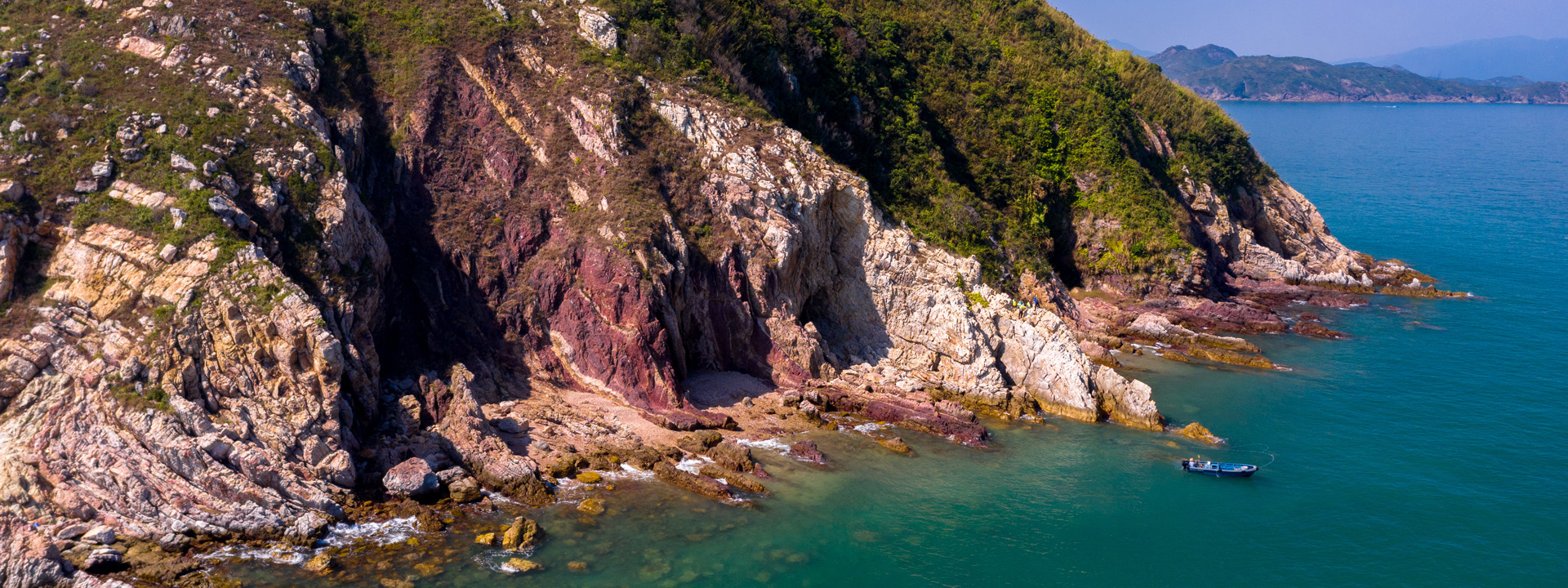
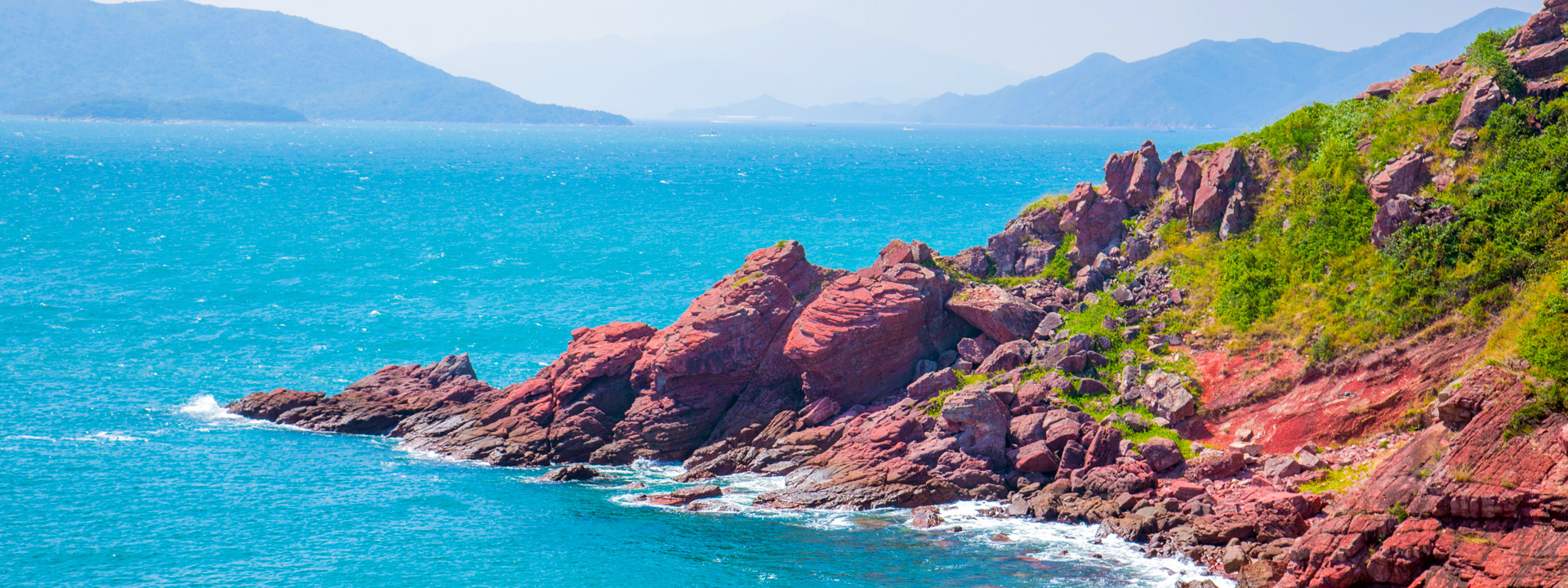
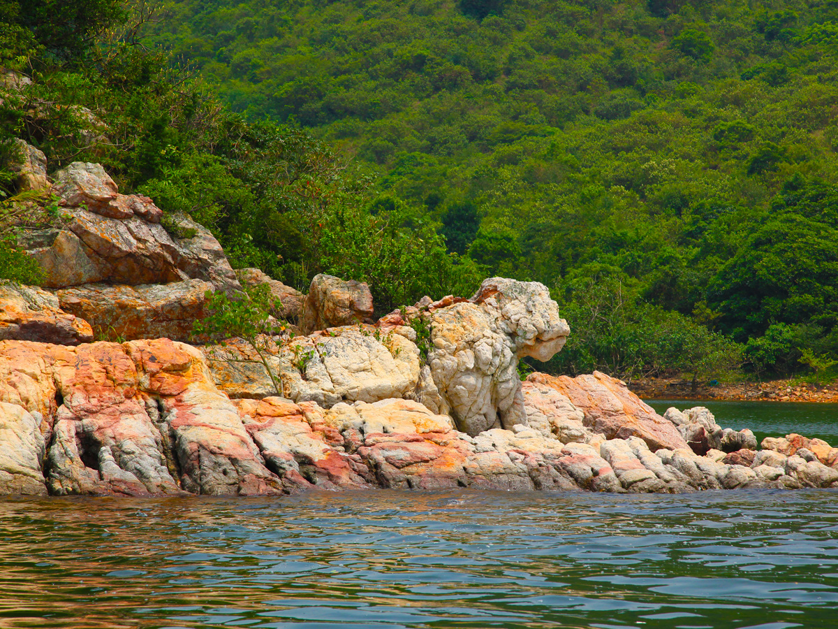
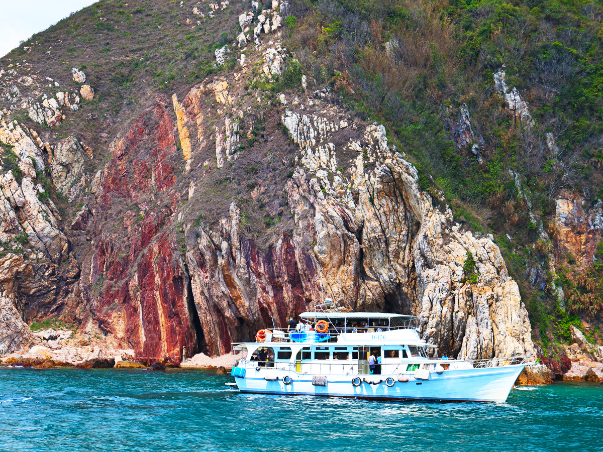
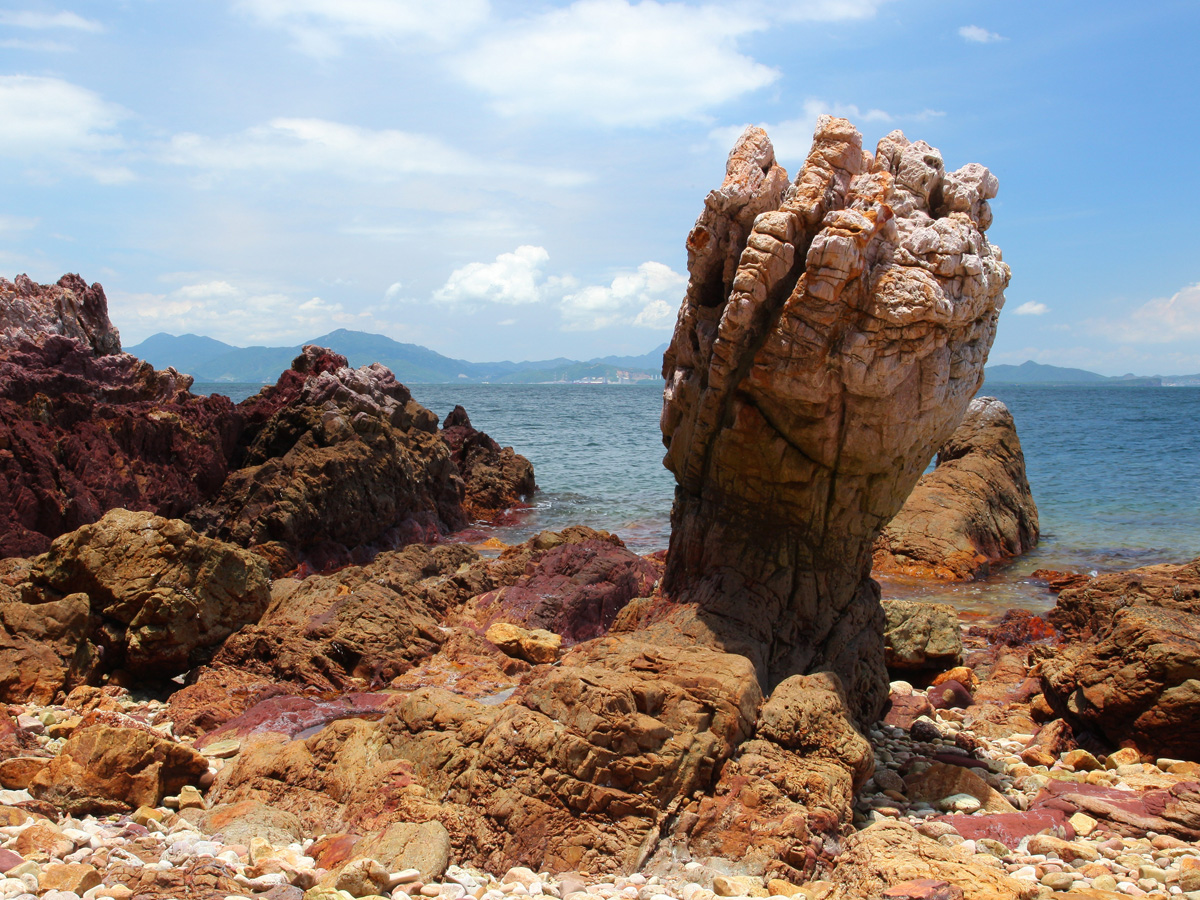
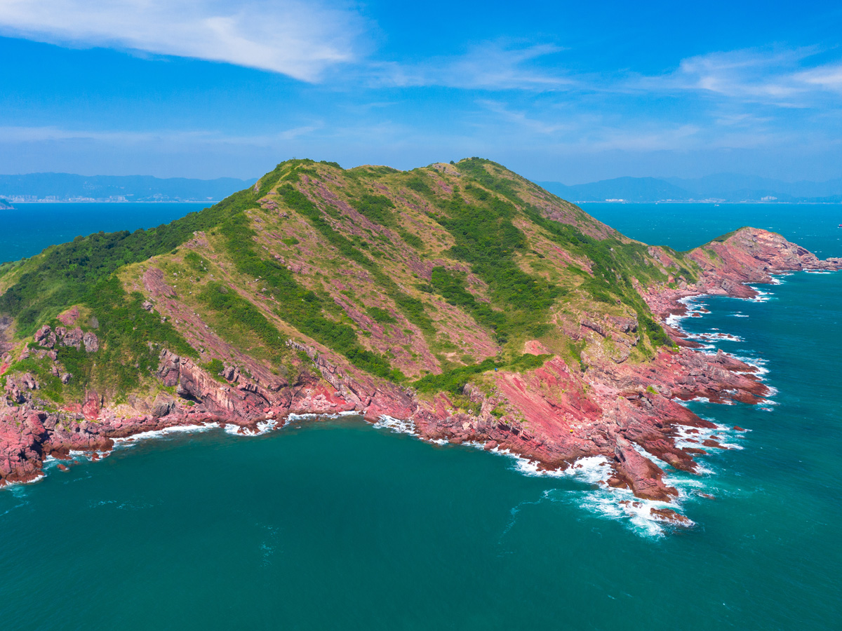
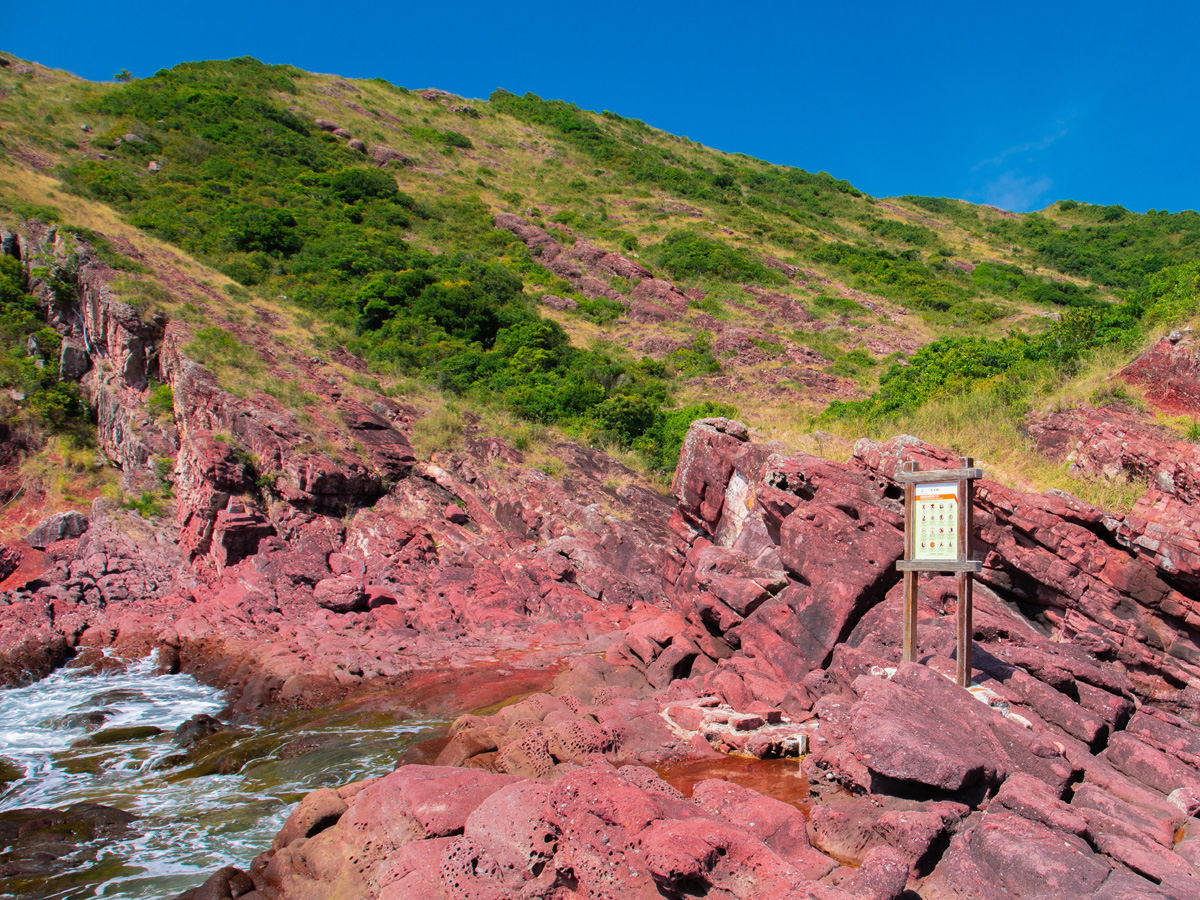
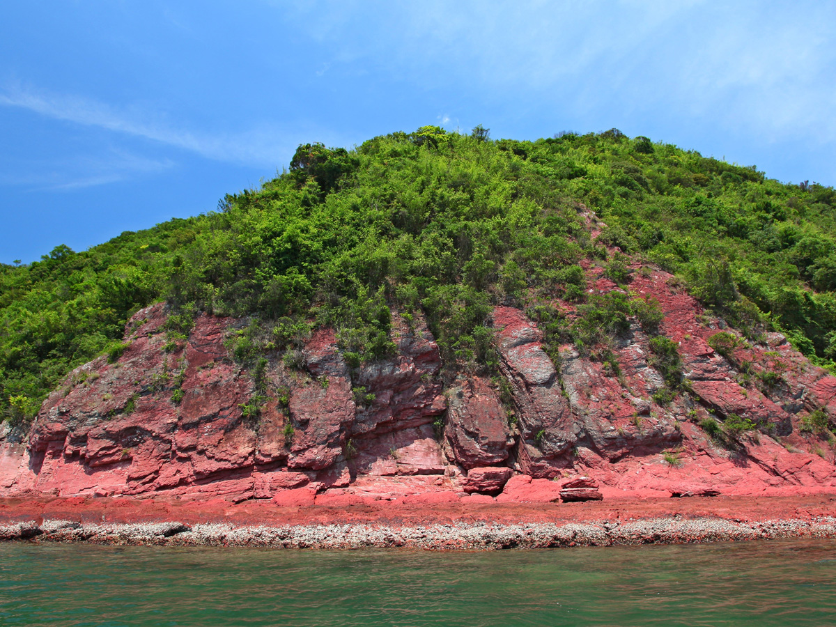
Bluff Head - Facing the open sea, Bluff Head, at the northeast end of Tolo Channel, is affected by very strong wind and waves, so the rock in the area is badly eroded. Waves a few stories high pound the shore, and the ground is covered by thin, high-salinity soil, which is not suitable for plant growth. The rock profile is therefore clearly visible. This area was impacted by folding and dislocation during tectonic movements, compressing the rock to a nearly vertical state. Known as the Fiery Red Waterfall or Pork Belly to hikers, Bluff Head’s alternating red and white sandstone and siltstone are most eye-catching. On the shore is a pictographic boulder in the shape of a fist, called Devil's Fist. It is a product of bedding erosion along the stratum caused by wind, waves and salt, which carved out several fingers and gaps between them. The base, at sea level, undergoing abrasion by waves and gravel every day, has been cut into the shape of a “wrist”. There is no proper pier or sightseeing trail at Bluff Head. Exploring ashore is not advised, as climbing the sheer cliffs and severely weathered rock is dangerous. Visitors are advised to stay on the boat and appreciate the geo-features from a distance. Port Island - As its Chinese name (Red Island) implies, Port Island is an island of red rock. However, it is not composed entirely of red sedimentary rock. The northwest part is volcanic rock, mainly ash-grey breccia-bearing tuff, formed some 143 million years ago during volcanic activity and covering part of the existing ground surface. At the end of the volcanic activity, the region changed to an arid climate for a long period. As there was a considerable temperature difference between day and night, the rock in the hills became weathered, and the iron in it was transformed into red iron oxide (pigment) through oxidation. The red gravel and silt created by weathering were washed downhill and settled in the flat lowlands and estuarine delta during seasonal rainstorms, where they were cemented over long geological processes and developed into sedimentary rocks with a unique red tone. These rock beds occur mainly in the southeast part of the island. The sedimentary rocks on Port Island actually sit on top of volcanic rock beds, but geological processes caused the strata to dip. The northwest part Port Island is volcanic rock, and the south part is sedimentary rock.Geological surveys show that the same types of rock are widely distributed across the entire seabed of Mirs Bay. Above sea level, Pak Sha Chau, an islet northwest of Port Island, and Shek Ngau Chau, east of Port Island, have the same rock assemblage as Port Island.
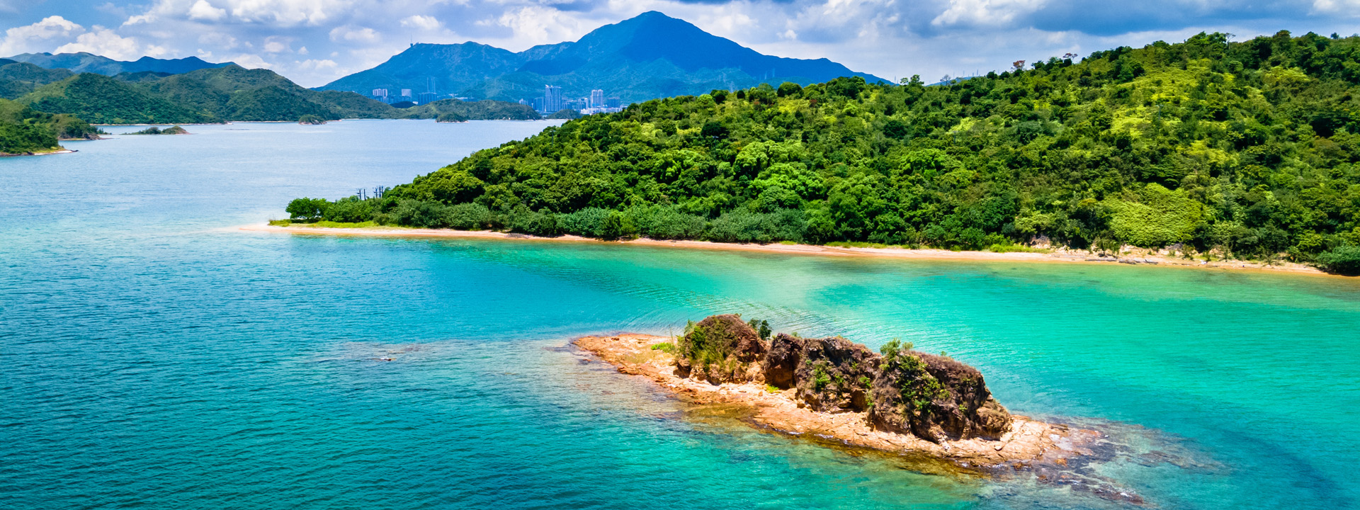
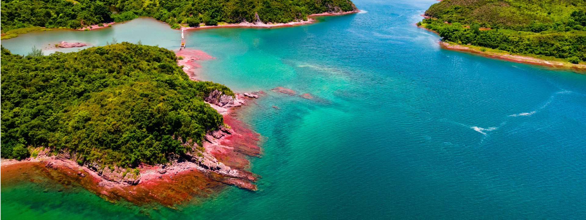
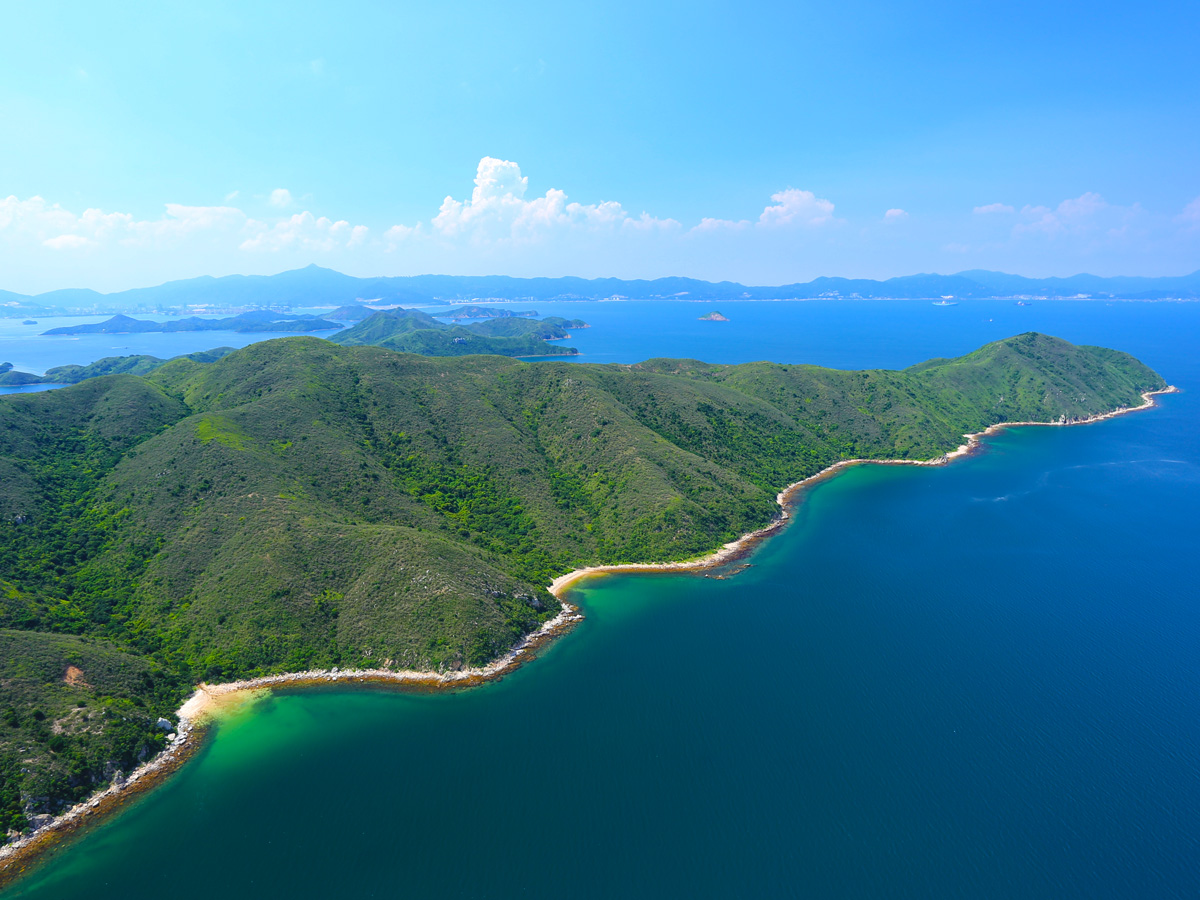
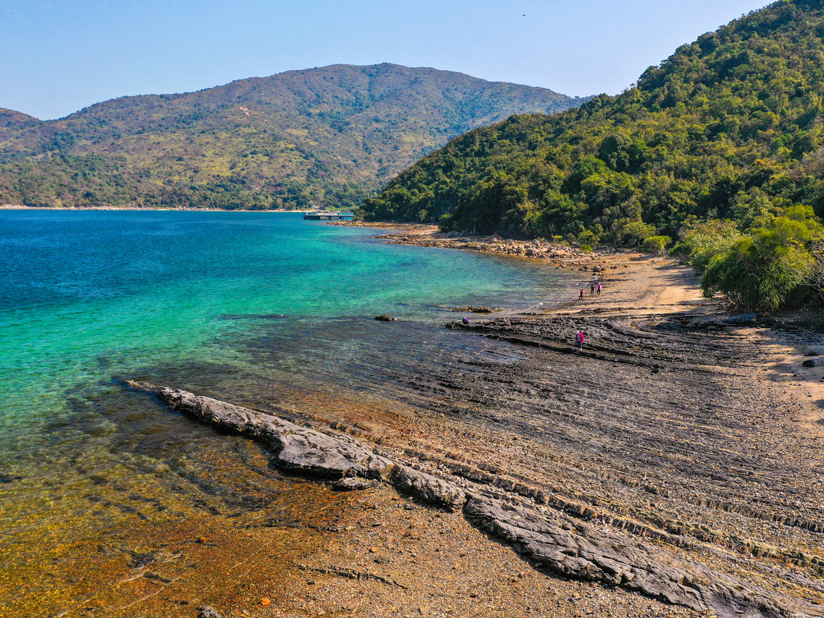
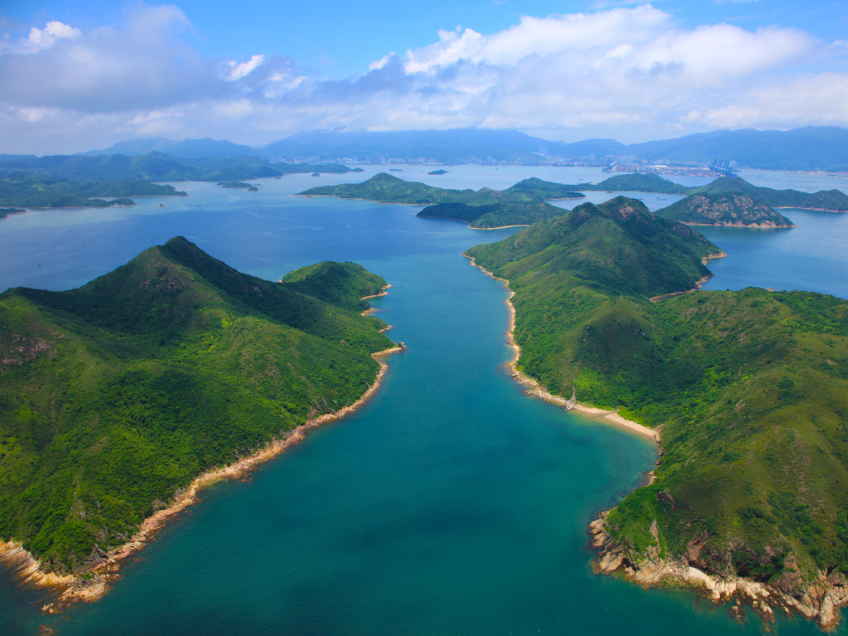
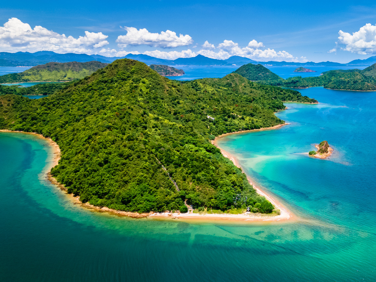
Double Haven is a marine region on the northeast coast of Plover Cove Country Park, nestled between Starling Inlet and Mirs Bay. As its English name vividly suggests, it is a natural haven, protected by a double barrier. This stretch of water is engulfed by peaks and islands, which shield it from high wind and big waves. Neither the southeast summer monsoon nor the chilly northwest winter monsoon disturbs this lovely sanctuary. The Chinese name, Yan Chau Tong, is taken from Yan Chau, an islet in Double Haven.Double Haven is a dreamy spot, where rolling green peaks meet crystal clear water. The mood is so serene that it is hard to believe you are actually in fast-paced Hong Kong. The local landscape has a little likeness to scenic Guilin, so many people call it Little Guilin of Hong Kong. Recognising the significant conservation value of Double Haven’s ecology, wildlife species and natural landscape, in 1996, the government designated Yan Chau Tong Marine Park.
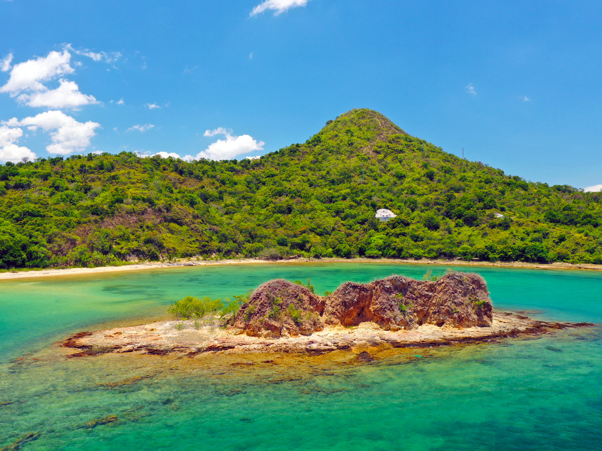
Most of the islands and shores in Double Haven are composed of volcanic rock. Tuff, comprising mainly consolidated volcanic ash, is widely distributed across Lai Chi Wo, Double Island, Crescent Island and Kat O, while small areas of agglomerate, volcanic breccia, lava and volcanic ash-bearing sedimentary rock made up of consolidated volcanic boulders, lava and volcanic ash occur in Sai Lau Kong. These strata are about 164 million years old. When the active volcanic stage came to the end, the eruptions gradually died down. What followed was an erosion and weathering stage, which lasted for some 20 million years. Rivers flowed down from the uplands, washing silt and gravel down to downstream coastal flats, where they eventually formed sedimentary rock strata about 500m thick, which is the conglomerate, sandstone and siltstone we see in Pat Sin Leng and Hung Shek Mun today.
According to folk legend, Double Haven has excellent fung shui. It is a majestic setting with six treasures: Yan Chau, which resembles a stone seal, Pak Ka Chau, a brush stand, Wong Fong Shan, a parasol, and Pak Sha Tau Tsui, an ink brush. A rock platoon represents an ink slab, and the calm water looks like a sheet of paper. These natural treasures are famous natural attractions of Double Haven.
Hung Shek Mun is known as the Red Coast, the 8km coastline that extends from north Bluff Head to Sam A Village is lined with bright red rock. Mun, meaning a narrow channel, is a term often used by the fishing community, while Hung Shek refers to the vivid red rock on the banks. Geologists believe the red strata was formed about 100 million years ago through the cementation of sand and gravel deposits in the estuarine delta in extended geological processes. They are sedimentary rocks.
Join a boat tour:
http://www.hkr2g.net/en_geotours.htm
Boat Trip to NENT Sedimentary Rock Region
| How to get there: | 1. By Ferry from Ma Liu Shui The Ma Liu Shui–Tung Ping Chau ferry and all ferries departing from Landing No. 3 of Ma Liu Shui Pier for Kat O, Ap Chau or Lai Chi Wo sail past marine and coastal geosites of the Northeast New Territories Sedimentary Rock Region, including Bluff Head, Port Island, Hung Shek Mun and Double Haven. 2. Join a Geopark Guide tour 3. Hire a sightseeing boat with appropriate safety features and insurance. |
How to Explore NENT Sedimentary Rock Region
Download the Above Route in PDF
Video of NENT Sedimentary Rock Region
Key of Attraction
Don't forget to take your time to visit them !!
Tolo Channel
Lo Fu Wat
Lai Chi Chong
Bluff Head
Bluff Head
Port Island
Port Island
Chik Mun Tau
Hung Shek Mun
Pak Ka Chau
Pak Sha Tau Tsui
Kat O
Location Map of NENT Sedimentary Rock Region
Enjoy Your Geopark Journey.


Last Review Date : 1 July 2021