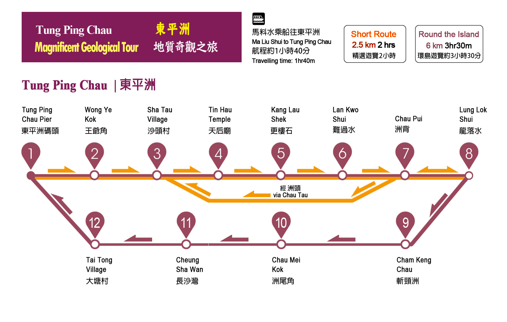
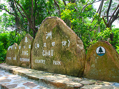
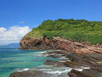
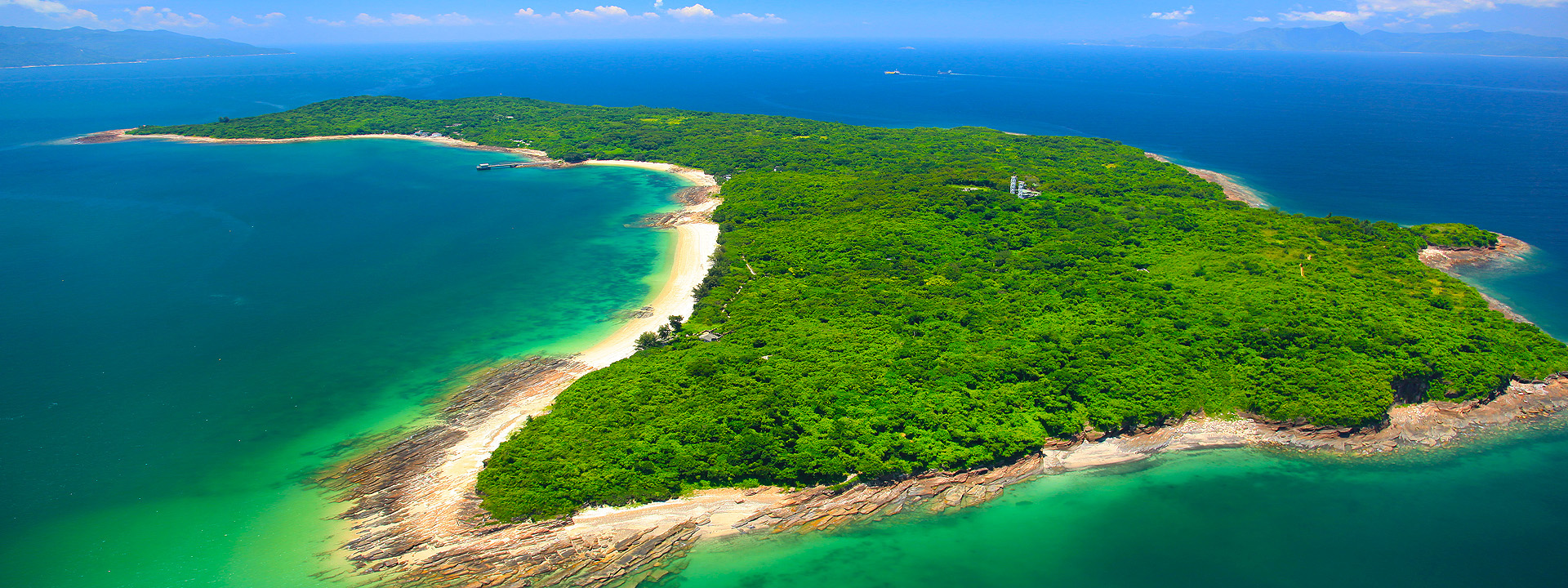
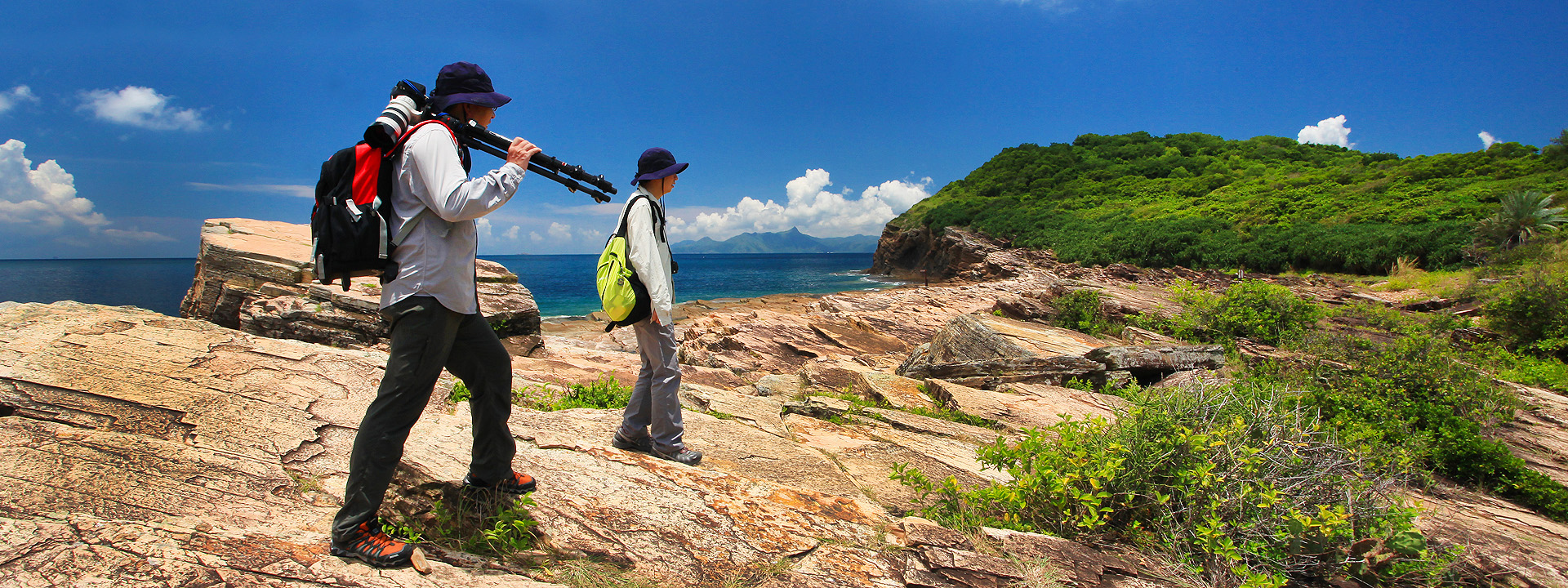
Hong Kong Geopark Logo


Tung Ping Chau


Easternmost Flat Island (One-day course)


Tung Ping Chau (Ping Chau) sits in Mirs Bay of the northeastern waters. It is the easternmost outlying island of Hong Kong. This crescent-shaped island, measuring 600 metres long and 2000 metres wide, is renowned for strange rock formations. Unlike most other rock types across the territory, the island is made up of sedimentary rock including siltstone, dolomitic siltstone, mudstone and chert. This sedimentary rock strata is known as Ping Chau Formation. Fossil studies, investigations of rock properties and regional geophysics, as well as research in climatic changes during ancient times have confirmed that this formation is the product of sedimentation which took place in Early Tertiary. Layer upon layer of rock form a bewildering structure. The strata looks just like a huge book, guarding great mysteries of geological history within its numerous pages. Since no sediments after Early Tertiary have successfully solidified into enduring rock, Ping Chau Formation is the youngest rock in Hong Kong's geological history. Tung Ping Chau is a popular holiday destination. Its many fascinating attractions, such as wave erosion landscape, the shale that resembles a layered sponge cake and the unusually flat lay of the island itself, have drawn thousands of visitors to the island.
Tung Ping Chau has the youngest rocks in Hong Kong and is renowned for its fine laminated and colourful sedimentary rocks. The Ping Chau Country Trail goes around the coast of Tung Ping Chau, starting at the Wong Ye Kok pier, and encircling the island. The trail is about 6km long and there are many sedimentary rock attractions and interesting landscapes along the way, including Kang Lau Shek, Lan Kwo Shui, Lung Lok Shui, Cham Keng Chau, wave-cut platforms and sea cliffs. The trail is generally level and well facilitated with interpretation signs and countryside facilities. It is suitable for general individual and group visitors.
Three flats are flat sea, flat island and flat rock. Tung Ping Chau is only 1.1 square kilometres in size. An island of extremely low elevations, it really lives up to its name. The highest point in the southeast, Hok Ngam Teng, rises a mere 48 metres above sea level, while the highest peak in the northwest, Au Kung Shan, is only 37 metres. As for the wonder, it refers to the shale.

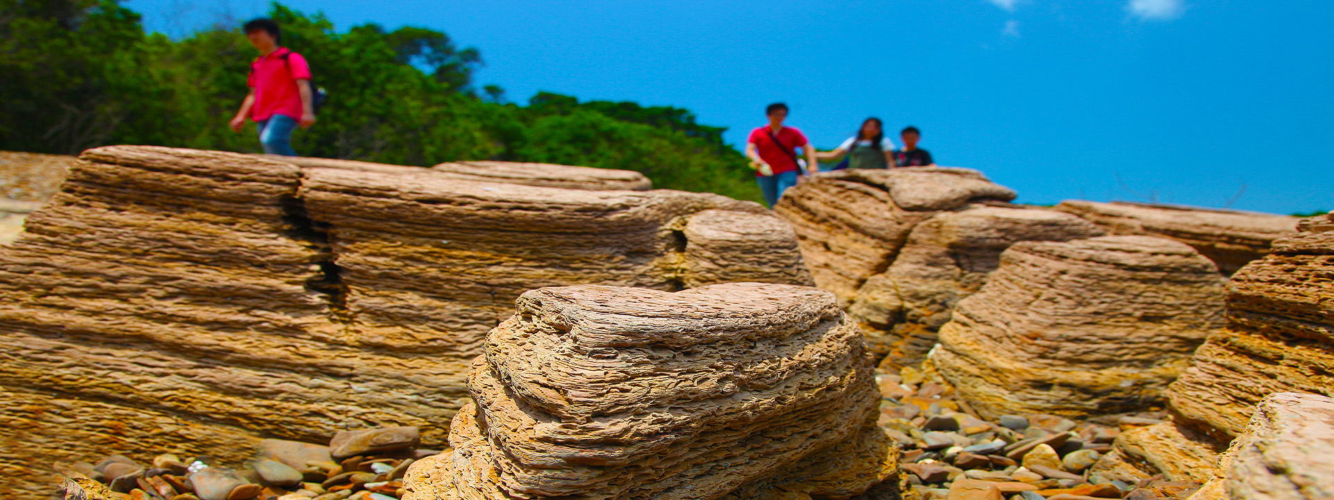
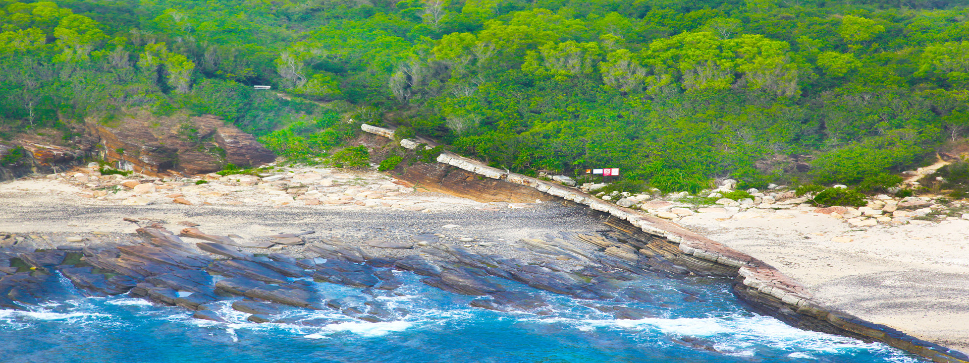
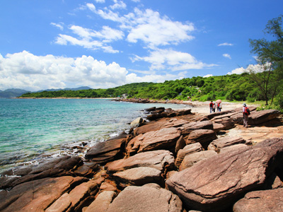
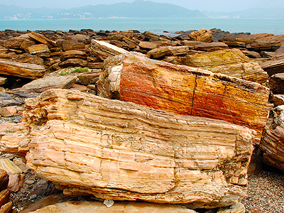
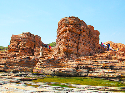
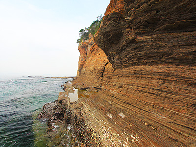
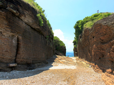
1. Clearly defined bedding and distinctive sheet conformation
This is the most significant characteristic of shale. Every layer is 1 to 5 mm thick. Overlapping each other, the coarser-grained siltstone layers and the finer-grained mudstone layers have clear lamination and sophisticated structure. These shale beds are believed to date from Late Cretaceous to Early Tertiary. It is a safe guess that Mirs Bay and Tung Ping Chau were a remote salt lake detached from land. As a result of sedimentation over long ages, shale resembling a layered sponge cake emerged in the hypoxic, highly salt and still water.

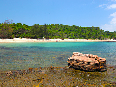
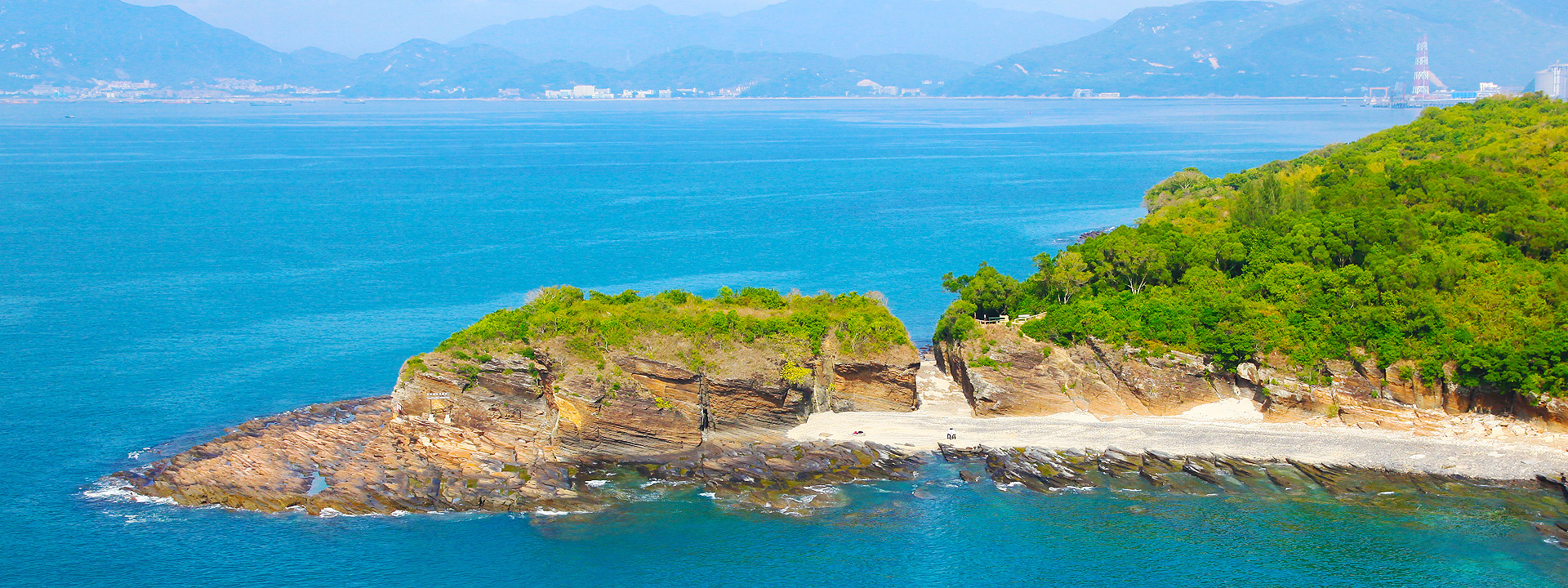
2. Attractive and colourful
Shale is usually made up of pyrite, geolite and augite. The vivid colours come from micrograined calcium, iron and magnesium particles that the rock contains. After formation, the rock was exposed to weathering and wave action, creating eye-dazzling plum, ochre, charcoal and bottle-green outcrops.

3. Vague ripple marks
Close observation will reveal vague or faint ripple marks in every layer. We can thus infer that the rock was close to the lake surface or submerged in relatively shallow water at the time of formation. In such setting, even small ripples would leave detectable marks.

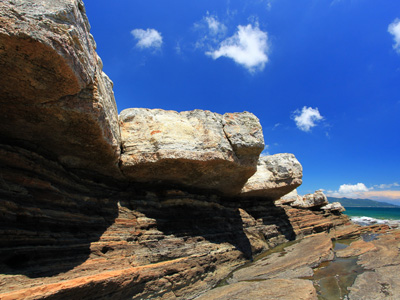
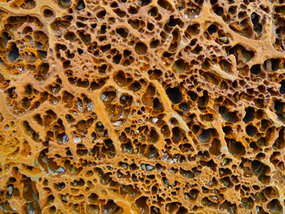
4. Emulsion and regeneration of vertical lamination
At Chau Mei Kok, you can find vertically fused or dotted reticulation on the shale sections caused by emulsion. As shale has high calcium content, when it is subjected to tidal, wave and sea current erosion, as well as impacts of salinization, wind, sun and rain, it develops melted calcium sections similar to stalactites. Later when the melted calcium is released, it flows out vertically at the outcrop tips or agglomerates into visible dotted reticulation. This is called vertical emulsion.


One-day Course to Tung Ping Chau


How to get there:

By Ferry from Ma Liu Shui

A ferry service runs between Ma Liu Shui and Tung Ping Chau. Visitors can travel by MTR East Rail and get off at the University Station, Exit B, then walk for about 15 minutes to Ma Liu Shui Pier for the ferry service to Tung Ping Chau. The normal boat traveling time is about 1 hour 40 minutes. Visitors are advised to take the *ferry schedule into consideration in planning the trip.

Service days: Saturdays, Sundays and Public Holidays

Depart from Ma Liu Shui: Saturday 9:00am and 3:30pm; Sunday and Public Holidays 9:00am.

Depart from Tung Ping Chau: Saturday, Sunday and Public Holidays 5:15pm

Fare: $100 return ticket

Enquiries: 2272 2000 (Tsui Wah Ferry Service (H.K.) Ltd.)

(subject to operator's announcement)


Tips: Weekend stores provide water and soft drinks at Tung Ping Chau. Remember to bring along enough water, foods, sunglasses and sun cap.


How to Explore Tung Ping Chau


travel route

Download the Above Route in PDF


Video of Tung Ping Chau


Key of Attraction

Don't forget to take your time to visit them !!


Tung Ping Chau Pier

Information Board

Wong Ye Kok

Stone Park Sign

Sha Tau Village

Tin Hau Temple

Sedimentary Rock

Kang Lau Shek

Sea & Sky

Lan Kwo Shui

Lung Lok Shui

Cham Keng Chau

Art of Erosion

Cheung Sha Wan

Tai Tong Wan

Stone-built House


Location Map of Tung Ping Chau


Enjoy Your Geopark Journey.


Brand Hong Kong          Web Content Accessibility Guidelines 2.0        OGCIO - Web Accessibility Recognition Scheme


| Disclaimer | Copyright Notice | Use of Photos | Web Accessibility Conformance | Privacy Policy | Site Map |
Last Review Date : 1 July 2021